


MARYLAND–(ENEWSPF)–August 26, 2017

Update
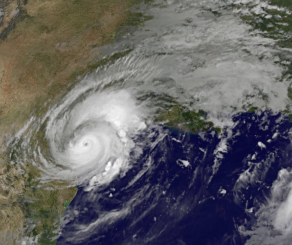
Satellites have been providing forecasters with valuable information as Harvey intensified to a Category 4 hurricane before making landfall in southeastern Texas. NASA’s GPM satellite and NOAA’s GOES-East…
Serving Park Forest, Illinois
MARYLAND–(ENEWSPF)–August 26, 2017
Update
Satellites have been providing forecasters with valuable information as Harvey intensified to a Category 4 hurricane before making landfall in southeastern Texas. NASA’s GPM satellite and NOAA’s GOES-East…


