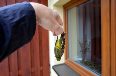
Environmental

Live Blog: Blizzard Shuts Down Nearly 400 Miles of I-40


Blizzard snowfall through Tuesday
(AccuWeather.com)

State College, PA-(ENEWSPF)- AccuWeather.com reports as the second major winter storm in a week takes shape across the southern High Plains, heavy windswept snow will clobber areas from Amarillo north to Dodge City, Wichita and Kansas City through Monday.

Travel on the roads and in the air will likely be brought to a standstill in these areas during the height of the storm as snowfall reaches immobilizing rates of 2-4"/hr. Winds could gust as high as 50 or even 60 mph in some locations, leading to widespread and dangerous blowing, drifting and whiteouts.

UPDATES:

8:40 a.m. CST Monday: Five inches of snow were reported in Shattuck, Okla. and there were widespread reports of three and a half to five inches of snow in southern Kansas. There were ten inches of snow reported in Morse, Texas, with snow drifting as deep as three feet. Twelve inches of snow have fallen in Dumas, Texas with snow drifts up to five feet. Eight inches of snow have fallen in Cayon and Spearman, Texas. 

8:10 a.m. CST Monday: Closing the airports at Amarillo and Lubbock has pushed those airports to the top of the delay list at FlightAware.com.

7:30 a.m. CST Monday: Amarillo, Texas, is getting wind damage from winds gusting to over 50 mph.

"The winds are tremendous out there," AccuWeather Meteorologist Henry Margusity said. "These are winds you’d normally see in a tropical storm."

7:10 a.m. CST Monday: From the National Weather Service in Albuquerque: "Interstate 40 is closed from the east side of Albuquerque ALL THE WAY to the TX/OK line, or 390 miles!"

6:55 a.m. CST Monday: As of 6 a.m. CST, the estimated snow depth at Clovis, N.M., is 9 inches. Eleven inches of snow have fallen near Amarillo, Texas, with drifts of snow up to two feet. More significant blowing and drifting is expected, making for difficult travel conditions.

6:35 a.m. CST Monday: A series of storms over the past few weeks have brought a lot of precipitation to the drought-stricken southern Plains. This storm is going to "very quickly get the Southern Plains to normal precip," AccuWeather Agricultural Meteorologist Dale Mohler said, which is important for the winter wheat crop. However, the area will need good rain for a few years to completely recover from the drought.

6:10 a.m. CST Monday: I-27 is closed in both directions from Amarillo to Lubbock, according to the National Weather Service in Amarillo. KCBD-TV in Lubbock reported that the Lubbock Preston International airport has also been shut down.

4:55 a.m. CST Monday: There is 5 inches of snow on the ground in Amarillo, TX as of 4:45AM CDT. Heavy snow and strong winds continue.

4:45 a.m. CST Monday: Heavy snow building southward now into places such as Plainview and Lubbock. Road conditions quickly becoming treacherous. Here’s a look at the latest snowmap:

Blizzard 2013 map

4:00 a.m. CST Monday: Heavy snow now starting to make its way into western Oklahoma and southwestern Kansas.

4:00 a.m. CST Monday: Winds are gusting 50-60 mph in spots across the Texas Panhandle as snow at falls 2-3 inches per hour.

3:20 a.m. CST Monday: Many roads closed or impassible across the Texas Panhandle as heavy snow, thunder and strong winds grip the region.

2:40 a.m. CST Monday: Heavy snow with winds gusting to 38 mph in Amarillo, Texas. Road cameras show very low visibility.

12:50 a.m. CST Monday: Moderate snow with lightning reported in both Amarilo and Pampa in Texas.

12:40 a.m. CST Monday: Wind gust to 69 mph just west of Lawton, OK according to MESONET.

12:30 a.m. CST Monday: Thundersnow reports coming out of the Texas Panhandle.

By Anthony Sagliani, Meteorologist for AccuWeather.com. All images AccuWeather.com.


ARCHIVES